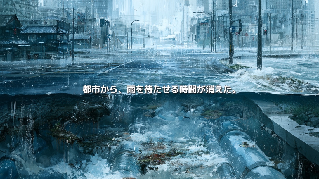
When rain falls on a city, the water quickly disappears.
Rain landing on rooftops enters gutters. Water on roads flows into drains and then travels through underground pipes toward rivers.
The ability to remove water quickly and keep roads and buildings usable is an essential urban function.
Over many decades, we have designed cities to dispose of rainfall as efficiently as possible.
But when a large amount of rain falls within a short period, the same system can begin to work against us.
Roads turn into rivers. Water pours into underground spaces and homes. Flooding occurs even in places far from major rivers.
Why does a city designed to drain rain quickly become so vulnerable to water?
Part of the answer lies in something that has disappeared from the urban surface:
time.
Cities Can Flood Even When Rivers Do Not Overflow
When we imagine flood damage, we often picture a river overtopping its banks and flowing into surrounding neighbourhoods.
But cities can flood even when nearby rivers remain within their channels.
When rainfall exceeds the capacity of sewers and drainage channels—or when high river levels prevent urban runoff from being discharged—rainwater has nowhere to go. It accumulates on streets and other low-lying surfaces.
This is known as pluvial flooding, or urban surface-water flooding.
Unlike fluvial flooding, which occurs when water escapes from a river, pluvial flooding begins with rain that falls inside the city and cannot be drained away.
This means that an area is not necessarily safe simply because there is no large river nearby.
Rainwater flowing across the urban surface tends to collect in low-lying districts, road underpasses, underground spaces, former waterways, and natural depressions.
Urban flooding cannot be understood by looking at rivers alone.
Rain Falling on Soil Behaves Differently from Rain Falling on Pavement
When rain falls on forests, grasslands, or farmland, some of it is intercepted by vegetation and some infiltrates the soil.
Not all of the water reaches a river at the same time.
Water that enters the ground moves slowly through the soil. It replenishes groundwater and gradually emerges into rivers and springs.
Depressions and wetlands can also hold water temporarily.
On surfaces covered by rooftops, asphalt, and concrete, however, much of the rainfall cannot infiltrate.
Instead, it flows across the paved surface and concentrates in gutters, drains, and stormwater pipes.
The change is not limited to the volume of runoff.
The speed of runoff also changes.
Materials published by Japan’s Ministry of Land, Infrastructure, Transport and Tourism on basin-wide flood management show that as urbanisation reduces the area where rainwater can infiltrate, runoff volume increases and reaches drainage systems more rapidly.
Even under the same amount of rainfall, water concentrates in sewers and rivers at different speeds depending on whether the land is dominated by soil and vegetation or by impermeable urban surfaces.
When the interval between the beginning of rainfall and peak runoff becomes shorter, drainage channels and sewer systems experience a much sharper surge.
Urbanisation does more than deprive land of its ability to absorb water.
It removes the time that once delayed rainfall on its journey through the city.
Does Greater Drainage Capacity Always Make a City Safer?
Sewer systems, pumping stations, underground storage facilities, and floodways have significantly reduced urban flood damage.
Without them, many cities would experience flooded roads and buildings even during ordinary rainfall.
The problem is not the existence of drainage infrastructure.
The problem is that the entire city is designed to deliver rainwater to that infrastructure at nearly the same time.
Every drainage pipe has a limit.
If rainfall intensity exceeds the conditions assumed when the system was designed, the pipes may fill completely and force water back toward the surface.
When downstream river levels are high, the amount of water that pumping stations can safely discharge may also be restricted.
Should cities simply continue installing larger pipes and building larger underground reservoirs?
Further investment remains important, but urban underground space is already occupied by water pipes, gas lines, electricity cables, communications networks, railways, and other infrastructure.
Land, construction time, and public funding are limited.
Even if drainage facilities are expanded, it is impossible to eliminate the possibility that future rainfall will exceed their capacity.
A strategy based only on moving water away faster will struggle to keep pace with a changing climate.
Low-Lying Places Preserve the Memory of Water
A city may appear flat, but its surface contains many subtle differences in elevation.
Former valleys, wetlands, ponds, rice fields, and abandoned river channels may still influence the movement of water.
Even when development and pavement have transformed the visible landscape, water continues to follow gravity and gather in lower places.
Place names and historical maps can sometimes reveal clues about how an area once interacted with water.
A place name alone, however, is not enough to determine present-day flood risk. Land reclamation, river engineering, and modern drainage systems may have significantly altered local conditions.
The purpose is not to romanticise the landscape of the past.
It is to combine historical topography, micro-elevation, past land use, present drainage networks, and flood-hazard information to understand why water concentrates in a particular place.
During ordinary weather, the underlying shape of a city is difficult to see.
During extreme rainfall, that hidden topography reappears through the movement of water.
Pluvial flooding can be understood as the temporary return of a landscape’s forgotten memory to the urban surface.
Roads and Underground Spaces Become New Waterways
Natural rivers are not the only routes through which water travels in a city.
During heavy rain, roads, stairways, subway entrances, underground car parks, and underpasses can become new channels.
Paved roads absorb little water. They also form continuous sloping surfaces that transport rainfall from higher ground toward intersections, depressions, and other low-lying locations.
Once water begins flowing into an underground space, conditions can become dangerous within a very short time.
If flooding causes a power failure, lighting, pumps, and elevators may stop working. What began as a transport disruption can quickly become a threat to human life.
Cities have connected ground-level and underground spaces to make movement and logistics more efficient.
During intense rainfall, the same connectivity can become a network for moving water.
A city that allows people to move efficiently can, under certain conditions, allow floodwater to move just as efficiently.
From “Drain It Away” to “Store, Absorb, and Delay”
The cities of the future do not need to abandon their drainage systems.
They need to add the functions of storing, absorbing, and delaying water to the existing ability to drain it.
Possible measures include:
- Installing rainwater tanks in homes and buildings
- Using school grounds, parks, and parking areas as temporary storage spaces
- Introducing permeable pavement on pavements and parking lots
- Directing road runoff into planted areas and rain gardens
- Using green roofs to delay stormwater runoff
- Maintaining the storage capacity of rice fields, wetlands, ponds, and agricultural land
- Requiring new developments to manage the additional runoff they generate within their own sites
A rain garden is a shallow planted depression designed to collect runoff, allow it to infiltrate the soil, or store it temporarily.
Each installation may be small. But when many are distributed throughout a watershed, they can delay the moment when rainwater reaches the sewer system.
In designated urban river basins, Japan’s Ministry of Land, Infrastructure, Transport and Tourism classifies development activities that increase stormwater runoff—such as paving land—as actions that inhibit rainwater infiltration.
Developments above a certain scale may therefore be required to install stormwater storage or infiltration facilities.
Changing the surface of a property is not an issue that ends at the property boundary.
Water discharged from one development must eventually be received by someone downstream.
Infiltration Alone Cannot Solve Every Problem
Allowing rainwater to infiltrate the ground is a valuable option, but it cannot be introduced in the same way everywhere.
Infiltration may create additional risks in areas with:
- High groundwater levels
- Soil with poor infiltration capacity
- Steep slopes
- Nearby underground structures
- Contaminated soil
- Unstable ground conditions
Facilities may also lose capacity when sediment, leaves, and other debris clog their surfaces.
The solution is not simply to “return the city to nature.”
Urban water management must respond to the specific topography, geology, groundwater, buildings, and drainage conditions of each location.
Storage, infiltration, and drainage must be combined appropriately.
Green infrastructure should not necessarily be viewed as a replacement for large-scale civil engineering.
It can instead complement existing infrastructure by restoring many small areas of flexibility throughout the city.
A Single Garden Is Part of the Watershed
Urban flood prevention is often associated with rivers, sewers, and other facilities managed by government agencies.
But rain does not distinguish between public and private property.
Residential rooftops, company parking lots, school grounds, and commercial sites all influence whether water is released immediately or held for a short time.
A single rainwater tank cannot prevent an entire city from flooding.
But the countless roofs, gardens, roads, parks, and open spaces across a watershed can be understood as parts of one water cycle.
This is also the essence of basin-wide flood management: moving beyond the idea that all water must be controlled within the river itself.
Flood risk must be addressed across the full system—from the catchment where rain falls, through the communities along the river, to the areas where water may eventually spread.
Water does not recognise municipal boundaries or property rights.
Flood-management strategies therefore cannot remain fragmented by facility, property, or administrative jurisdiction.
Cities Need Places Where Rain Can Wait
Cities have developed by removing water as quickly as possible.
Future cities must preserve that function while also creating places where rainfall can wait temporarily.
Depressions in parks.
Storage beneath school grounds.
Building roofs.
Planted roadside areas.
Residential rainwater tanks.
Remaining farmland and wetlands.
Individually, these spaces may appear insignificant.
Connected across a watershed, however, they can spread out the timing of runoff and prevent all the water from reaching sewers and rivers at once.
A flood-resilient city is not a city capable of forcing every drop of water away.
It is a city that understands where water will gather, accepts part of it, releases it gradually, and limits the damage when overflow occurs.
Part of every disaster comes from the sky.
Another part is created by what we have built on the ground.
Urban pluvial flooding is one of the clearest and most familiar expressions of that structure.
We cannot stop rain from falling.
But we can redesign how quickly it is collected, where it flows, and where it is allowed to wait after reaching the ground.
Urban flood management is beginning to shift from moving water away faster to giving the city back its lost time.
References
- Ministry of Land, Infrastructure, Transport and Tourism: Full-Scale Implementation of Basin-Wide Flood Management Through the Designation of Specified Urban Rivers
- Ministry of Land, Infrastructure, Transport and Tourism: Urban Flood-Management Measures
- Ministry of Land, Infrastructure, Transport and Tourism: Promoting the Installation of Rainwater Infiltration Facilities
- Ministry of Land, Infrastructure, Transport and Tourism: Visualising the Effects of Rain Gardens and Stormwater-Storage Facilities
- Ministry of the Environment, Japan: Building a Society in Harmony with Nature Through Green Infrastructure
- National Institute for Land and Infrastructure Management: Climate Change Adaptation Research