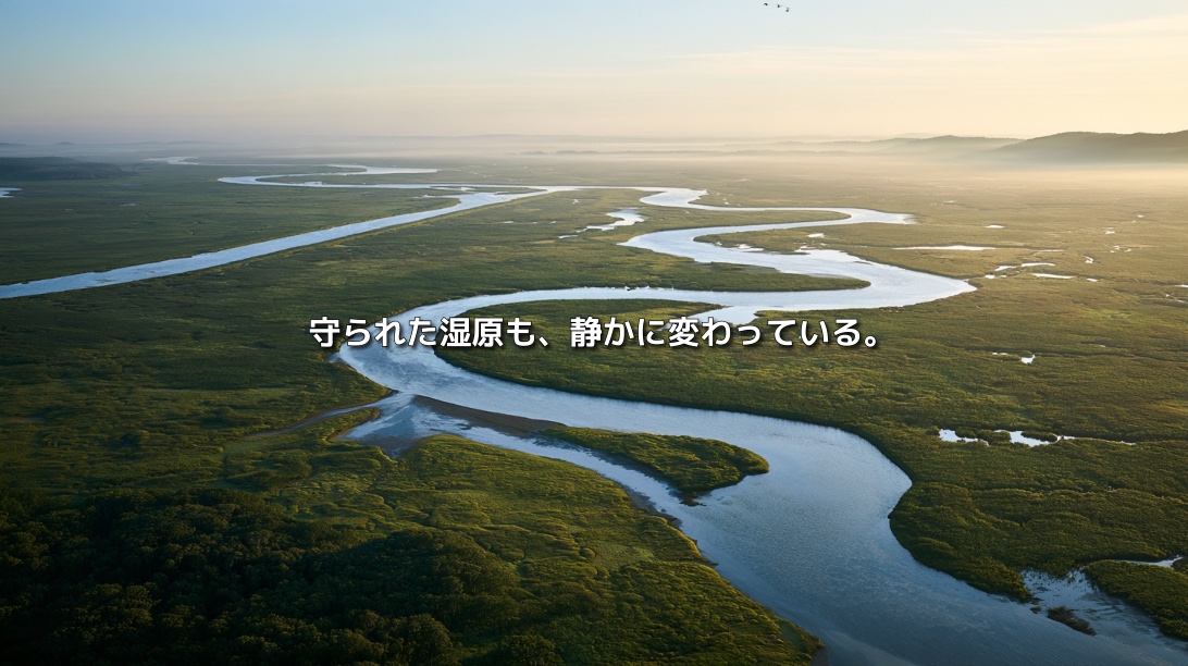
Kushiro Wetland stretches across eastern Hokkaido.
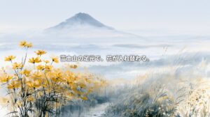
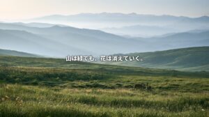
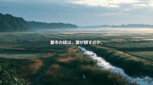
From an observation deck, the Kushiro River can be seen winding gently through reed beds that reach toward the horizon. With few buildings in sight, the landscape appears untouched—a wilderness beyond the reach of human activity.
Red-crowned cranes move through the marsh. White-tailed eagles and Steller’s sea eagles visit its waterways. Siberian salamanders and Sakhalin taimen inhabit environments shaped by cold water and a cool climate.
In 1980, Kushiro became Japan’s first wetland designated under the Ramsar Convention. In 1987, it was designated a national park centered on the wetland itself.
It is easy to assume that such a celebrated landscape is already secure.
Yet quiet changes continue within it.
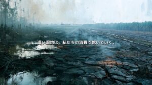
Alder woodland is expanding into some areas formerly dominated by reeds and sedges. Sediment and nutrients arriving from upstream accumulate, altering water movement and ground levels. Forest clearance, agricultural development and river straightening in the surrounding basin affect the wetland’s water cycle.
Protecting the marsh itself cannot control everything that flows into it.
Kushiro Wetland reveals a fundamental challenge of conservation: drawing a boundary around an ecosystem cannot protect all the relationships that sustain it.
Japan’s Largest Marsh Was Once Beneath the Sea
Kushiro Wetland extends across Kushiro City, Kushiro Town, Shibecha Town and Tsurui Village.
Its present landscape emerged through a long history of changing sea levels.
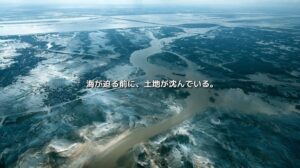
After the last ice age, rising seas reached into the area now occupied by the wetland. Later, changes in sea level and the development of coastal sandbars left lakes and shallow water bodies behind them.
Rivers supplied sediment. Dead plant material accumulated. Reeds and sedges spread across poorly drained ground.
In waterlogged conditions, plant remains decomposed slowly, forming peat. Over long periods, these processes created the marsh.
The landscape was never a finished object.
It developed through interactions among the sea, rivers, sediment, vegetation and water levels.
The Ramsar-designated site covers 7,863 hectares, a protected area within the larger wetland landscape. Much of Kushiro is characterized by reed and sedge communities alongside alder woodland.
These wetland environments depend strongly on water supplied by rivers and groundwater.
Changes far upstream can therefore eventually appear in the marsh’s vegetation and landforms.
A Wetland Cannot Exist Within Its Boundaries Alone
Maps show the boundaries of national parks and wildlife protection areas.
Water does not recognize them.
Rain falling on upstream forests and farmland enters small streams and rivers, carrying sediment and nutrients toward the wetland.
The marsh is sustained by the entire catchment: the Kushiro River and its tributaries, forests, pasture, agricultural land and settlements.
Forest clearance can change how much rain infiltrates the soil and how quickly water runs across the surface. Fine sediment washed from exposed ground and farmland enters rivers and moves downstream.
Roads, drainage channels and river engineering can alter where water travels and how quickly it arrives—even when rainfall remains the same.
Protecting a wetland therefore involves more than preventing construction within it.
It also requires attention to what enters the wetland, where it comes from and how it gets there.
How Does Additional Sediment Change a Marsh?
Rivers naturally carry sediment.
It builds riverbanks and floodplains and provides a foundation for vegetation. Kushiro Wetland itself formed partly through the accumulation of sediment and plant remains.
The difficulty arises when the amount and rate of delivery change.
When land use increases erosion, additional sand and mud can accumulate in river channels and along wetland margins.
The ground surface rises slightly.
The duration of inundation may shorten.
Places once dominated by wetland grasses and sedges can become more suitable for trees and other vegetation.
This rarely takes the form of a marsh disappearing in a single storm.
Thin layers accumulate year after year.
Channels change shape.
Plant communities gradually shift.
To a visitor, the landscape may appear largely unchanged. Over decades, however, its ecological character can change substantially.
A wetland’s decline cannot be measured only by the loss of its area.
It may remain on the map while changes in water levels, vegetation and wildlife weaken its ecological functions.
What Does Expanding Alder Woodland Tell Us?
The expansion of alder woodland is frequently discussed as a sign of change in Kushiro Wetland.
Alders are native trees capable of growing in wet conditions. They have long been part of this landscape.
Their presence is therefore not, by itself, evidence of damage.
Wetlands are dynamic ecosystems. Sediment accumulation and changing water levels can naturally lead to transitions from open marsh to shrubland or woodland.
Some alder expansion reflects these processes.
Where woodland rapidly spreads into areas formerly dominated by reeds and sedges, however, increased sediment and nutrient inputs or altered water conditions may be contributing.
Sediment deposition can raise the ground surface and shorten periods of flooding.
Additional nutrients can change plant growth.
Once established, trees add leaves and branches to the ground and alter shade, vegetation and local microclimates.
Expanding woodland can reduce habitat for species that depend on open reed and sedge marshes.
The task is to understand why alders are increasing in particular places and at particular rates.
Changes in vegetation can help reveal changes in the basin’s water and sediment flows.
Upstream Land Use Leaves Its Mark Downstream
Agricultural development, road construction and river engineering expanded around Kushiro Wetland after the Second World War.
Dairy farming developed in eastern Hokkaido’s cool climate. Some forests and uncultivated land became pasture. Drainage channels were constructed to make wet ground usable, and rivers were modified.
These activities support local livelihoods and the regional economy.
They also influence water retention, sediment movement and water quality.
Soil washed from pasture and exposed ground can enter rivers. Nitrogen and phosphorus associated with fertilizers and livestock manure can also move downstream with water.
The wetland occupies a low-lying position in the catchment.
It receives the consequences of activities farther upstream.
Wetlands can help retain sediment and nutrients, but that capacity is finite. When incoming loads exceed what the ecosystem can accommodate, the wetland itself changes.
Kushiro is both a protected landscape and a place where the effects of catchment-wide land use accumulate.
Why Were Rivers Straightened?
The Kushiro River and its tributaries once meandered through and around the wetland.
Meandering channels generally create a longer route for water. During floods, water can spread across adjacent floodplains and deposit sediment.
For farming and settlement, however, these conditions can be difficult to manage.
Sections of river were straightened to improve drainage, move floodwater away more quickly and make neighboring land easier to use.
The objectives were understandable:
- Protect farmland from flooding.
- Drain wet ground.
- Stabilize river channels and surrounding land use.
But shortening a channel can increase its gradient and accelerate the movement of water.
Water may leave the wetland more quickly.
Riverbeds and banks can erode, sending sediment downstream.
Where floods spread less frequently across surrounding land, the connection between river and wetland can weaken.
Straightening changes more than the route of a river.
It can alter flow velocity, sediment transport, groundwater conditions, fish habitat and floodplain vegetation.
Restoring a River’s Bends
At Kushiro, restoration has included returning a straightened section of river to a former meandering course.
A prominent example is the old-channel restoration project at Kayanuma in Shibecha Town.
Using a former channel that remained in the landscape, the project restored approximately 2.4 kilometers of meandering river.
Its aims included slowing the flow, raising ordinary water levels, restoring opportunities for flooding into the surrounding wetland and reducing sediment transport farther downstream.
This required deliberate intervention.
Which former channel should be used?
What should happen to the straightened channel?
How far should floodwater be allowed to spread?
How could impacts on residents, farmland and roads be managed?
Surveying, design, construction and continued monitoring were all necessary.
Ecological restoration can involve carefully rebuilding the conditions that allow natural processes to function.
Will Restoring Meanders Immediately Restore the Wetland?
Returning a river closer to its former course does not instantly recreate its former ecosystem.
Riverbed elevation, surrounding vegetation, groundwater conditions and incoming sediment may all differ from those before straightening.
Climate and land use have changed too.
Restoration therefore requires long-term observation.
Does water spread into the surrounding wetland again?
How does vegetation respond?
Do habitats for fish and bottom-dwelling organisms improve?
Where does sediment settle?
No single indicator can establish success.
A change that benefits wildlife may also affect nearby agricultural land or infrastructure. Allowing floodwater back into a wetland requires careful consideration of where it will go.
Restoration is an ongoing effort to find workable relationships between a changing ecosystem and the society around it.
Downstream Restoration Also Requires Upstream Action
Restoring meanders and retaining sediment in suitable areas cannot compensate indefinitely for excessive inputs from upstream.
Work across the catchment is also needed.
That can include restoring vegetation along riverbanks, reducing exposed soil, intercepting sediment and nutrients from farmland, adjusting drainage channels and improving the water-retention capacity of forests.
A problem first observed downstream may have originated far away.
Addressing it requires tracing the flow back to its source.
From Protecting Cranes to Protecting an Ecosystem
The conservation history of Kushiro Wetland is closely associated with the red-crowned crane.
After the species was feared to have disappeared from Japan, cranes were rediscovered in the Kushiro area. Protection of breeding grounds and winter feeding contributed to the recovery of the resident population.
The crane became a powerful symbol of wetland conservation.
Such species can attract public attention, funding and institutional support.
But wetland protection must extend to the wider habitat.
Reed beds, sedge marshes, alder woodland, rivers and lakes form a mosaic that supports many different organisms.
Cranes themselves need food, nesting sites, suitable waterside habitat and conditions that allow them to survive winter.
Protecting one species leads back to the relationships between water and land that sustain its life.
Kushiro’s restoration efforts can be understood as an expansion of that conservation vision—from an iconic bird to the ecological processes of an entire catchment.
Does National Park Status Keep Nature Unchanged?
National park designation and Ramsar recognition are important.
They help regulate development, protect habitats and communicate the international value of wetlands.
But designation does not freeze an ecosystem in time.
Climate changes.
Rivers carry sediment.
Plants expand and retreat.
People continue to farm, work and live around the protected area.
Changes beyond its boundaries enter through water, air and living organisms.
Conservation requires observing these changes, understanding their causes and adjusting land use and water management where necessary.
The work continues after the boundary is drawn.
A Tourism Landscape and a Living Catchment
Kushiro Wetland is also an important tourism resource.
Observation decks, boardwalks, canoeing and birdwatching allow visitors to experience it. Tourism creates income and employment, helping make conservation valuable to the regional economy.
Yet the catchment is also home to farmers, businesses and residents.
Restrictions introduced for conservation can affect their livelihoods and operating decisions.
Long-term cooperation becomes difficult if upstream landowners bear the costs of reducing runoff while tourism businesses and urban communities receive most of the benefits.
Catchment-wide conservation therefore requires decisions about how to share benefits and burdens.
Possible approaches include support for farming practices that protect the wetland, compensation for land used as riparian buffers, environmental education and arrangements that connect tourism revenue with conservation work.
Ecological restoration depends on economic relationships and public agreement as well as scientific knowledge.
Recovering the Wetland’s Functions
Restoration may suggest returning a landscape completely to its predevelopment condition.
But the Kushiro catchment now contains farmland, roads, railways, housing and industry.
Its earlier state cannot simply be reproduced.
Even historical targets for river width, water levels or vegetation may be difficult to maintain under present conditions.
A more useful focus is the recovery of ecological functions:
- Temporarily storing water.
- Slowing river flow.
- Retaining sediment and nutrients.
- Connecting habitats.
- Maintaining conditions for carbon storage in peat.
- Providing space for floodwater.
How much of this can be recovered within today’s landscape?
The goal is to rebuild the conditions that allow the wetland to respond, change and recover.
Looking Beyond the View
The scenery from Kushiro’s observation decks remains expansive.
A river winds through reeds. Hills rise in the distance.
That beauty can make gradual change difficult to recognize.
Sediment accumulates.
Water levels shift.
Alder woodland spreads into some reed beds.
Connections between river and marsh weaken.
These changes are difficult to read in a tourist photograph.
An ecosystem can begin losing its character and functions long before the landscape ceases to look beautiful.
To understand Kushiro Wetland, we need to ask where its water comes from.
Upstream forests.
Pasture.
Drainage channels.
Straightened rivers.
Settlements and roads.
The view before us reflects relationships with all of them.
Protecting the Wetland Means Reworking the Relationships of a River Basin
Kushiro Wetland belongs to a connected social and ecological system: forests, farmland, rivers, industries, tourism and everyday life.
A river once straightened can be allowed to bend again.
Land once drained can retain more water.
Sediment problems can be addressed at their upstream sources.
Water management can extend across the catchment rather than stop at the edge of a protected area.
These efforts rebuild relationships between people and the processes that sustain the wetland.
What is being restored reaches beyond reed beds and river bends.
It includes connections between upstream and downstream, development and conservation, livelihoods and ecosystems.
The wetland lies low in the catchment.
It receives, in the end, the consequences of how society has used the land.
Kushiro’s changing marsh asks us to reconsider how we manage landscapes that water connects, but administrative boundaries divide.
References
- Ministry of the Environment, Japan — Kushiroshitsugen National Park
- Ministry of the Environment, Japan — Ramsar Sites in Japan
- Ministry of the Environment, Japan — Biodiversity Center of Japan
- Public Participation in Kushiro Wetland Restoration
- Hokkaido Regional Development Bureau — Kushiro Wetland Nature Restoration Council