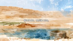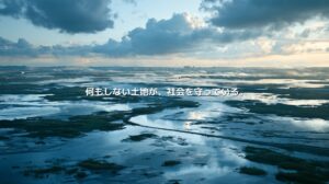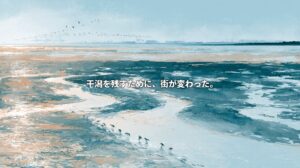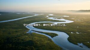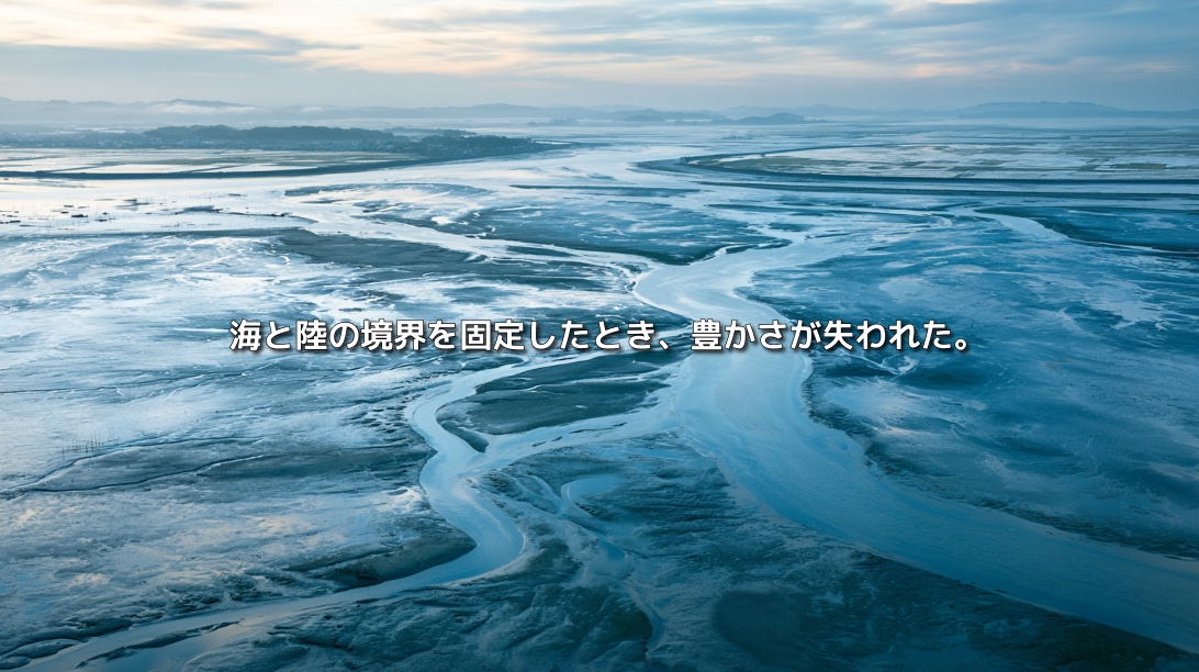
The sea retreats into the distance.
At low tide, a vast plain of mud appears before the horizon. Mudskippers move across its surface. Fiddler crabs raise their oversized claws. Beneath the mud, worms and shellfish feed on organic matter, becoming food for fish and birds.
A few hours later, the sea returns.
River-borne nutrients mix with seawater. The tides carry water, sediment and living organisms through the bay.
In the Ariake Sea, the boundary between land and water shifts twice a day.
Its large tidal range and extensive tidal flats have supported exceptional biological productivity: nori seaweed, Manila clams, pen shells, ark shells, fish and crabs. Along its shores, livelihoods developed around the rhythm of the tides.
Yet significant environmental changes have been reported since the latter half of the twentieth century.
Algal blooms.
Low oxygen near the seabed.
Declining shellfish populations.
Discoloration of cultivated nori.
Changes in seabed sediments.
Falling catches.
The Isahaya Bay reclamation project has become a powerful symbol of these changes.
A sea dike approximately seven kilometers long separated the inner bay from the sea, creating agricultural land and a regulating reservoir. The project sought to develop farmland and improve protection against flooding and storm surges. Its effects on tidal currents, tidal flats and ecosystems have remained subjects of prolonged debate.
But the Ariake Sea’s changes cannot all be explained by a single dike.
River sediment supply, coastal reclamation, marine sand extraction, nutrient dynamics, aquaculture, seabed conditions and climate change interact differently across locations and seasons.
The challenge is to sustain flood protection, agriculture, fisheries and ecosystems within the same sea and its river basins.
A Sea Shaped by One of Japan’s Largest Tidal Ranges
The Ariake Sea is an enclosed coastal sea surrounded by Fukuoka, Saga, Nagasaki and Kumamoto prefectures.
Its narrowing, shallow inner reaches amplify the tide entering from the open sea. Depending on location and timing, the difference between high and low tide can reach approximately six meters.
This exposes extensive tidal flats at low water.
The Ariake Sea is often described as containing roughly 40 percent of Japan’s total tidal-flat area.
At first glance, these flats may look like empty expanses of mud.
They contain microalgae, worms, shellfish and small crustaceans. They provide nursery and feeding habitats for fish and stopover sites for migratory shorebirds.
Mudskippers, eel gobies and fiddler crabs inhabit environments shaped by a distinctive combination of conditions:
- A large tidal range.
- Freshwater and sediment supplied by rivers.
- Brackish water where fresh and salt water mix.
- Mud-rich seabed sediments.
The Ariake Sea’s abundance depends on more than clean water.
It depends on the continual movement and exchange of water, sediment, nutrients and organisms.
Tidal Flats Are Working Coastal Ecosystems
Tidal flats were once frequently regarded as undeveloped land that could be converted into farmland or industrial sites.
Exposed at low tide and submerged at high tide, they were difficult to build on and inconvenient for navigation.
Yet they perform many functions at the boundary between land and sea.
They receive organic matter and nutrients from rivers.
Microbes and bottom-dwelling organisms process those materials.
Bivalves filter seawater, consuming phytoplankton and suspended particles.
The flats produce food for fish and birds, help attenuate waves and participate in carbon and nitrogen cycling.
They receive material, transform it and pass it through the ecosystem.
Reclaiming a tidal flat creates usable land.
At the same time, it removes habitat and can diminish water-quality regulation, biological production and coastal protection.
The gain in land and the loss of ecological functions occur together.
The “Guillotine” That Closed Isahaya Bay
On April 14, 1997, the sea dike at Isahaya Bay was closed.
Images of approximately 300 steel plates being lowered into the water became known as the “guillotine,” an enduring symbol of the reclamation project.
Construction began in 1986, and the project was completed in 2008.
Its stated objectives were to create large, level agricultural plots and strengthen disaster protection for surrounding low-lying areas.
The approximately seven-kilometer dike separated the sea from an inland regulating reservoir. Keeping the reservoir’s water level low was intended to improve drainage and help protect surrounding areas against flooding and storm surges.
Potatoes, carrots, onions and other crops are grown on the reclaimed land.
For the farmers working there, this is the foundation of their livelihoods.
For nearby residents, drainage and disaster protection are practical needs.
Meanwhile, the dike disconnected the inner bay’s tidal flats from the sea.
A place where tides rose and fell, freshwater mixed with seawater and organisms moved between habitats became farmland and a reservoir intended to hold freshwater.
A boundary built for agriculture and safety also interrupted ecological exchanges.
What Happens When Tidal Movement Changes?
Tides drive much of the Ariake Sea’s water movement.
Water enters the inner bay as the tide rises and moves seaward as it falls. This movement mixes seawater and transports oxygen, nutrients and sediment.
Closing part of a bay reduces the area through which tidal water can move.
It can consequently alter nearby water levels, current speeds, tidal timing and sediment transport.
Assessing effects across the entire Ariake Sea, however, is difficult.
Currents also depend on seabed topography, water depth, wind, river discharge, atmospheric pressure and seasonal conditions. Sand extraction, dredging and other reclamation projects have modified the marine landscape too.
Observed changes differ according to the location and period studied.
Research has examined the effects of the Isahaya closure, but debate remains over the contribution it has made to particular environmental changes across the wider sea.
Useful questions must be specific.
Which area?
Which season?
Which process?
How large an effect?
The Ariake Sea requires analysis that recognizes these differences.
Algal Blooms Depend on More Than Nutrient Levels
An algal bloom occurs when certain phytoplankton or other microscopic organisms multiply rapidly. Some blooms discolor the water and are commonly called red tides.
Their development depends on nutrients such as nitrogen and phosphorus, alongside sunlight, temperature, salinity, currents and water-column stability.
A bloom therefore cannot always be explained simply as a consequence of pollution.
When water mixes well and organisms are dispersed, nutrient inputs may not produce a large bloom.
When conditions allow phytoplankton to remain in favorable surface waters, rapid growth may become more likely.
The species involved also matters.
Large diatom blooms can consume nutrients that cultivated nori needs, contributing to discoloration. Harmful species may directly damage fish or shellfish.
Reducing nutrient inputs may help address some bloom risks.
But excessive nutrient reduction can also limit nori growth and the biological production supporting fisheries.
Managing the Ariake Sea requires balancing pollution control with the nutrients needed for a productive ecosystem.
When Oxygen Runs Low Near the Seabed
Hypoxia—low dissolved oxygen—is a recurring concern in the Ariake Sea.
During summer, warmer conditions and freshwater inflows can help create a layered water column. Less dense water remains near the surface, while denser, saltier water lies below.
This stratification restricts vertical mixing.
Near the seabed, microbes consume oxygen as they decompose organic matter. If oxygen is not replenished sufficiently from above, bottom waters become oxygen-poor.
Some fish can move away.
Manila clams, pen shells and ark shells living on or within the seabed have much less ability to escape.
Prolonged hypoxia can impair growth and increase mortality.
Its formation depends on interacting conditions: organic matter, stratification, currents, seabed characteristics, temperature and wind.
A single intervention is therefore unlikely to resolve every episode.
Shellfish Are Both a Harvest and Part of the Sea’s Functioning
Bivalves draw in water and filter out phytoplankton and organic particles.
Some of this material becomes part of their bodies; some is transferred to the seabed. Harvesting shellfish also removes nitrogen and phosphorus contained in their biomass.
Shellfish fisheries consequently interact with the sea’s nutrient and particle cycles.
When bivalve populations decline, the loss extends beyond fishing income.
Their capacity to process suspended material can diminish.
Environmental deterioration reduces shellfish populations.
Fewer shellfish may then alter filtration and material cycling, potentially reinforcing unfavorable conditions.
In an ecosystem, the decline of a species can be both a consequence of change and a contributor to further change.
Why Have Manila Clams and Pen Shells Declined?
Shellfish declines in the Ariake Sea have multiple possible drivers:
- Hypoxia.
- Increasingly muddy or fine-grained seabed sediments.
- Deposits of easily resuspended mud.
- Changes in food availability.
- Changes in currents transporting larvae.
- Predation and disease.
- Low salinity following heavy rainfall.
- Fishing pressure.
- Loss of tidal-flat habitat.
Their importance varies by species, location and period.
Pen shells are large bivalves that live partly buried in the seabed. Low oxygen can harm them, while deposits of fine mud can interfere with feeding and respiration.
Manila clams require suitable conditions for larvae to settle and juveniles to survive, including appropriate sediment, salinity, food and water movement.
Releasing adult shellfish cannot restore a population if the habitat does not support its next generation.
Fisheries recovery depends on rebuilding the conditions for reproduction and survival as well as managing catches.
Nori Farming and the Nutrient Balance
The Ariake Sea is one of Japan’s leading nori-producing regions.
Nori absorbs nitrogen and phosphorus from seawater. Its growth also depends on winter water temperatures, sunlight, salinity and currents.
When nutrients become insufficient, pigment levels decline and the seaweed loses color. Quality and commercial value can fall.
Excessive nutrient availability, however, can contribute to blooms and increased organic matter under suitable conditions.
A policy focused only on reducing inputs can therefore conflict with the needs of nori cultivation.
Management must examine when nutrients arrive, where they go, their form and how organisms use them.
The objective is a sea that supports biological production while limiting damaging accumulation and oxygen depletion.
Rivers Are Delivering Different Materials
Many rivers, including the Chikugo River, flow into the Ariake Sea.
They supply freshwater, sediment, nutrients and organic matter.
Upstream dams and erosion-control structures alter sediment transport. River engineering, sand extraction and land use in forests, farms and cities also affect what reaches the coast.
Tidal flats depend partly on river-borne sediment and partly on mud and sand redistributed by tidal currents.
Reduced sediment supply can contribute to erosion or habitat loss in some locations.
Conversely, large pulses of fine sediment, organic matter and freshwater during heavy rain can place stress on seabed habitats and marine organisms.
Changes in rainfall patterns affect the timing and concentration of these inputs, alongside their annual totals.
Understanding the Ariake Sea therefore requires looking inland—to forests, farmland, urban areas and dams.
Fixed Boundaries and a Moving Ecosystem
The Isahaya sea dike established a clear division between the sea and the reservoir.
For agriculture and disaster protection, such divisions have practical value.
They allow water levels to be managed, limit seawater intrusion, provide drainage and stabilize conditions for land use.
Tidal-flat ecosystems depend on a boundary that moves.
The tide rises and the land becomes sea.
The tide falls and the seabed is exposed.
Freshwater and seawater mix.
Sediment and organisms move.
For tidal flats, this variability is a condition of ecological functioning.
Human land use often seeks a stable boundary.
Coastal water cycles continually move that boundary.
At Isahaya, these two requirements occupy the same place.
Would Opening the Gates Restore Everything?
Proposals to open the dike’s drainage gates and admit seawater into the reservoir have been debated for years.
Such investigations have been proposed as a way to observe changes in currents, water quality, sediments and organisms, and to examine connections between reclamation and environmental change.
But seawater entry could also affect agricultural water supplies, salinity, drainage and the operation of disaster-protection facilities.
For farmers on the reclaimed land, these are questions about crops and household income.
Time has also passed since the closure. New environmental conditions and land uses have developed.
Opening the gates would not immediately recreate the former tidal flats.
Any assessment must account for accumulated sediment, existing water quality, present habitats and surrounding infrastructure.
Restoration requires identifying which lost functions can be recovered, by what means and to what extent.
Why a Single-Cause Explanation Falls Short
The Isahaya reclamation project has strong symbolic importance.
The loss of inner-bay tidal habitat and its separation from the sea are clear.
But attributing every change in the Ariake Sea to that project can obscure other pressures.
These include altered river sediment supply, sand extraction, dredging, inputs from households and industry, agricultural runoff, declining shellfish stocks, changing fisheries and aquaculture, and climate-related changes.
The Ariake Sea is not a uniform body of water.
Its inner reaches, central waters, entrance, river mouths and Isahaya Bay differ in depth, sediments, currents and freshwater influence.
Effective restoration requires understanding how pressures combine in each area.
Multiple Causes Still Require Action
Describing environmental change as complex can sound like an attempt to avoid responsibility.
Yet complexity does not mean that nothing is known.
Reclamation removes tidal habitat.
Dikes alter water exchange across the areas they separate.
Organic matter decomposition consumes oxygen.
Restricted mixing can prevent oxygen replenishment.
Changes in shellfish abundance affect filtration and material cycling.
What is harder to establish is the precise share of every factor in the sea’s overall changes.
Action need not wait until every contribution has been quantified.
An adaptive approach uses the strongest available evidence, monitors the results of interventions and adjusts management as understanding improves.
Can Constructed Tidal Flats Recover Lost Functions?
Restoration measures in the Ariake Sea have included creating tidal flats and shallow-water habitats, adding sand to muddy seabeds, excavating channels, supporting shellfish populations and improving sediment conditions.
Sand capping can provide more suitable substrate for species such as Manila clams.
Channel excavation can improve water movement or drainage.
Protecting adult breeding stocks can increase larval supply.
These measures can contribute to recovery.
But a functioning tidal flat depends on more than the presence of sand or mud.
Water levels, currents, salinity, topography, microalgae, bottom-dwelling organisms and connections with nearby habitats all matter.
Added sand may wash away under strong currents. Released shellfish may fail to survive if hypoxia persists.
Restoration should therefore be assessed by ecological performance as well as constructed area.
Can organisms establish themselves?
Can they reproduce?
Does the habitat continue providing food and participating in water-quality regulation?
Fishers Are Observers of the Sea
People who work on the Ariake Sea have accumulated detailed knowledge of its changes.
The speed of the tide.
The firmness of the mud.
Where shellfish can be found.
When fish arrive.
The color of nori.
Relationships between wind and water temperature.
Their experience contains observations specific to places and times that monitoring equipment may miss.
Scientific surveys complement that knowledge by measuring oxygen, nutrients, plankton, sediments and currents in ways that allow comparison across sites and years.
Combining these approaches can help identify unusual conditions and investigate their causes.
Fishers can participate as collaborators in long-term observation and research.
Making Room for Both Farming and Fishing
Debate over Isahaya Bay is sometimes framed as a conflict between farmers on reclaimed land and fishers in the Ariake Sea.
Both depend on water and land.
Farmers need workable soils, reliable water supplies, drainage and disaster protection.
Fishers need suitable currents, habitats, water quality and recovering biological resources.
An approach that requires one group to absorb the loss of its livelihood cannot easily build lasting agreement.
Attention must also turn to the institutions that approved development, manage the environment and distribute costs and benefits.
Restoration costs should not fall solely on individual farmers.
Fisheries losses should not simply be left to fishers as unavoidable natural variation.
Agriculture, fishing, safety and ecosystem functions need to be evaluated together.
Compensation, alternative water supplies, protective infrastructure, habitat restoration and monitoring all require decisions about shared funding.
What appears to be a conflict between occupations also reflects the difficulty of bringing their needs into the same policy framework.
Protecting More Than Hectares
Tidal-flat conservation is often measured by area.
Area matters.
But a flat can retain its mapped extent while losing ecological function.
If sediment supply changes, oxygen becomes insufficient or larvae cannot reach suitable habitat, the same area may support fewer organisms.
Conservation must sustain the processes within it:
- Tidal exchange.
- Connections between rivers and the sea.
- Larval movement.
- Shellfish filtration.
- Feeding habitats for fish and birds.
- Sediment transport, erosion and deposition.
A tidal flat is an ecosystem maintained through movement.
Where Should the Coast Be Fixed—and Where Should It Move?
People have built coastal societies by stabilizing the boundary between land and sea.
Dikes protect settlements.
Reclamation creates farmland.
River engineering controls flooding.
Ports and roads support industry.
These interventions provide safety, food and infrastructure.
Wetlands and tidal flats, meanwhile, function through changing water levels, salinity, sediment movement and biological exchange.
Removing variability can make land easier to use while reducing the ecological productivity that variability sustained.
Future coastal management must make choices about where firm protection is necessary and where space can remain for tides, changing habitats and floodwater.
Cities and farmland need protection.
Coastal ecosystems also need room to function.
The Ariake Sea brings these requirements into the same field of view.
Restoration Requires a Combination of Responses
There is no single intervention that will restore every part of the Ariake Sea.
Opening gates would not immediately recover the former ecosystem.
Constructing habitat would not guarantee successful reproduction.
Reducing nutrients too far could affect nori and marine production; excessive inputs under unfavorable conditions could increase bloom and hypoxia risks.
A coordinated approach must address the different problems of different areas.
Manage sediment and nutrient inputs from rivers.
Restore tidal flats and shallow habitats.
Support conditions in which shellfish can reproduce.
Monitor low-oxygen waters.
Combine fishers’ observations with scientific measurements.
Account for warmer waters and heavy rainfall.
Reduce or compensate for impacts on agriculture and disaster protection.
Evaluate results and revise measures when necessary.
Restoration means developing workable relationships between livelihoods and ecosystems under present conditions.
Tidal Flats Give the Sea Room to Breathe
At low tide, the vast mud plain belongs neither entirely to land nor entirely to water.
A few hours later, it is submerged again.
Within that shifting space, shellfish filter water, microbes process organic matter, young fish grow and migratory birds feed.
Tidal flats give the sea room to breathe.
By filling that space and fixing its boundaries, people have gained farmland and protection.
When ecological exchanges weaken, the consequences return to society through fisheries, water quality and biodiversity.
The Ariake Sea asks how several values occupying the same place—safety, agriculture, fishing and ecosystem health—can be sustained together.
Do we see an empty expanse of mud?
Or infrastructure that supports marine life and coastal livelihoods?
The future of the Ariake Sea depends partly on how we value the space between land and water.
References
- Ministry of the Environment, Japan — Interim Report of the Committee for Comprehensive Investigation and Evaluation of the Ariake Sea, Yatsushiro Sea and Related Waters
- Ministry of Agriculture, Forestry and Fisheries, Kyushu Regional Agricultural Administration Office — Isahaya Bay Reclamation Project
- Ministry of Agriculture, Forestry and Fisheries, Kyushu Regional Agricultural Administration Office — Project Overview
- Original Japanese Article — NEOTERRAIN Journal