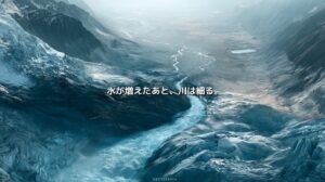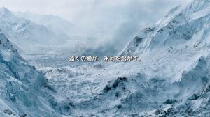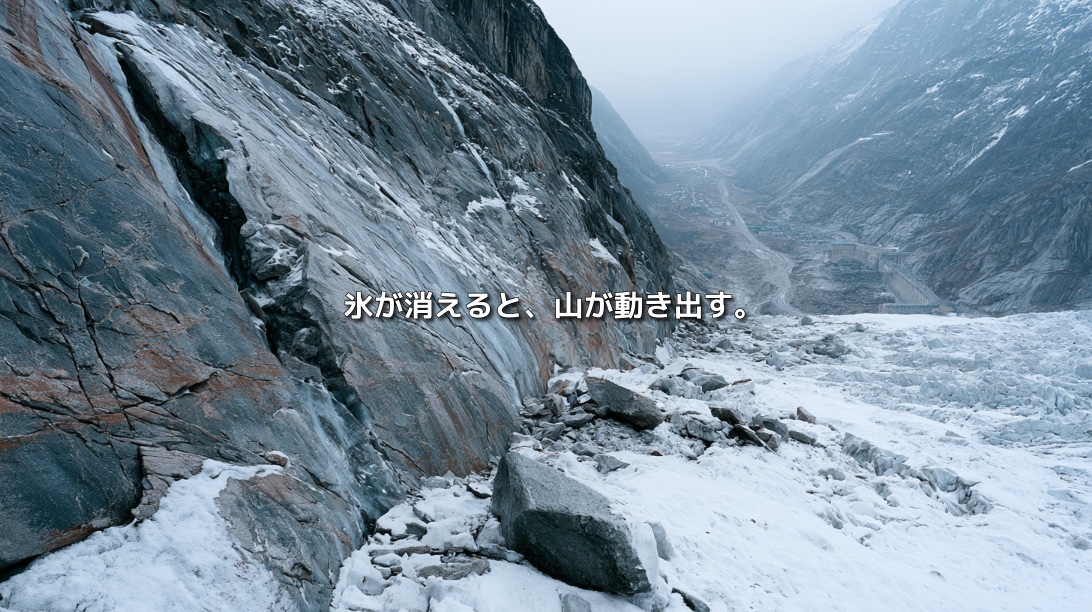
As glaciers retreat, rock walls once hidden beneath white ice come into view. At first, the exposed slopes may look like newly revealed land.
But they are not necessarily stable. For years, the ice may have supported and cooled the rock. Its disappearance exposes the slope to a different balance of forces and temperatures.
High mountain rock also contains permafrost: ground that remains frozen year-round. Where ice fills fractures in the rock, it can help hold parts of a slope together. As that ice warms and thaws, fractures may widen and water may penetrate deeper into the mountain.
The glacier crisis does not end with the loss of ice. It can also change the stability of the mountain left behind. neoterrainjournal.com
Permafrost Exists Beyond the Arctic
Permafrost is ground that stays at or below 0°C for at least two consecutive years. Although it is often associated with Siberia and Alaska, it also occurs in high mountain regions, including the Alps, Himalayas, Tibetan Plateau, Andes and Rocky Mountains.
Mountain permafrost is rarely uniform. Elevation, slope aspect, snow cover, sunlight, rock type and groundwater all affect where frozen ground forms. A layer near the surface may thaw in summer and refreeze in winter. This active layer lies above ground that remains frozen throughout the year.
As temperatures rise, the active layer can deepen and heat can reach farther into the rock. Permafrost does not vanish all at once. Its gradual warming changes conditions inside a mountain, largely out of sight. neoterrainjournal.com
Ice Can Help Hold a Mountain Together
A rock wall is not one solid block. It contains fractures, faults and gaps. When water enters these openings and freezes, the resulting ice can help bind parts of the rock together.
As the rock warms, that bond may weaken even before the ice melts completely. Meltwater can then move into fractures, and rising water pressure may help force them apart.
Where temperatures repeatedly cross the freezing point, water can freeze, expand and thaw again. Over time, these cycles may widen cracks. A rockfall can happen suddenly, but the conditions that made it possible may have developed inside the slope for years or decades. neoterrainjournal.com
Glaciers Have Also Supported Mountain Slopes
A thick glacier filling a valley can press against the rock walls beside it. In some places, that contact helps support the lower part of a slope. When the glacier retreats, that support is reduced or lost.
The newly exposed rock also comes into direct contact with sunlight, rain, air and meltwater. Pressure, temperature and groundwater flow change. Collapse is not inevitable, but a slope may become less stable as it adjusts.
Scientists use the term paraglacial to describe landscape changes that continue after glacier retreat. The disappearance of a glacier is not the end of a mountain’s transformation. Permafrost thaw, repeated freezing and thawing, heavy rain, rapid snowmelt and earthquakes may interact with the loss of glacier support, potentially contributing to rockfalls and larger slope failures. neoterrainjournal.com
The Warming Beneath the Alps
The European Alps are among the better monitored regions for mountain permafrost. Researchers have measured subsurface temperatures in boreholes on high mountain slopes over many years.
A 2024 study analysed 64 boreholes across European mountain and northern regions. At some sites, temperatures 10 metres below the surface rose by more than 1°C per decade during 2013–2022. Daily changes in air temperature do not directly reach that depth; warming there points to a longer-term change within the ground.
Another 2024 study of a Swiss Alpine slope found evidence that climate warming contributed to growing rockfall activity over roughly a century. That does not mean every falling rock can be attributed to climate change. Geology, existing fractures, rainfall, snow, earthquakes and the shape of a slope all matter. Long-term observations are limited, too.
The evidence calls for care in explaining individual events. It also shows why warming permafrost and retreating glaciers must be considered when assessing how mountain slopes may change. Nature Geoscience
In the Himalayas, Monitoring Remains Limited
The Hindu Kush Himalaya contains extensive mountain permafrost, but long-term observations remain sparse in many areas. Satellites can reveal changes at the surface, while temperatures and ice within a rock wall are much harder to measure remotely.
Nearby are settlements, roads, trekking and pilgrimage routes, and hydropower facilities. In a narrow valley, a landslide can cut off access to an entire community. Damage to power infrastructure can affect people much farther downstream.
The challenge is not simply identifying hazards that are already visible. It is gathering enough observations to understand how the ground is changing. ICIMOD has called for expanded permafrost monitoring across the region. neoterrainjournal.com
One Collapse Can Trigger Another Disaster
A rock collapse high in the mountains may set off a chain of events.
Falling rock can strike a glacier, entrain ice and snow, and rush down a valley as a rock–ice avalanche. Rock entering a glacial lake can create a wave that overtops or damages its natural dam. Debris can also block a river, forming a temporary lake that may later drain suddenly.
A change beginning on an uninhabited mountainside can therefore reach roads, power facilities and communities many kilometres downstream. This is what makes cascading hazards in mountain regions so difficult to manage. neoterrainjournal.com
What Happened at Blatten in 2025
On 28 May 2025, a major rock collapse occurred above the village of Blatten in southern Switzerland. Rock fell onto the Birch Glacier, and the resulting rock–ice avalanche travelled down the valley. Much of the village was buried, and the river was blocked.
The slope had been monitored, allowing residents to evacuate before the main collapse. A study published in 2026 estimated that approximately 9.3 million cubic metres of rock and ice moved during the event.
The Blatten disaster cannot be explained by permafrost thaw alone. Rock structure, slope movement, the glacier and other local conditions must all be considered. The event nevertheless raises a wider question: as glaciers retreat and frozen mountain ground warms, will safety assessments based on past terrain remain adequate? neoterrainjournal.com
Trails, Mountain Huts and Roads Can Move Too
Large collapses are only one concern. Changes in frozen ground can gradually deform the foundations of mountain huts, cable-car supports and roads. Trails may become unstable, while pipelines and power lines may be damaged.
Infrastructure built on ground assumed to be stable may face different conditions decades later. Monitoring and maintenance must account for the possibility that the ground itself is changing. neoterrainjournal.com
How Can a Changing Mountain Be Monitored?
Predicting the exact date and size of a rock collapse far in advance is difficult. Monitoring can, however, detect changes that support evacuations or temporary closures.
Useful methods include:
- Measuring ground temperature in boreholes
- Tracking slope movement with GPS and satellite radar
- Comparing drone images and aerial photographs to identify new fractures
- Detecting small vibrations and sounds produced by cracking rock
- Measuring changes in groundwater and snowmelt
- Using cameras to record a slope continuously
- Studying past rockfalls and the underlying geology
No single measurement reveals everything happening inside a mountain. Temperature, movement, water, weather and rock structure need to be assessed together. At Blatten, observing the slope’s movement helped create time for residents to leave. neoterrainjournal.com
Hazard Maps Must Keep Changing
Hazard maps often draw on the places where past collapses occurred and the distances debris travelled. Those records remain valuable, but the conditions that shaped them are changing.
A retreating glacier can expose a slope that was previously supported by ice. A new glacial lake can create a route by which falling rock triggers flooding. Sites without a recorded collapse may develop new risks.
Hazard maps therefore need regular updates that reflect glacier position, ground temperature, slope movement, lake growth and the ways people use land downstream. Alongside a map of what happened before, mountain communities need an evolving picture of how the terrain is changing now. neoterrainjournal.com
The Risk Does Not End When a Glacier Disappears
Glacier retreat is easy to see: the white ice grows smaller. Permafrost thaw is harder to see because it takes place within the ground and the rock.
A slope that has lost glacier support may continue adjusting for years. Water can enter fractures, temperatures can rise deeper within the rock, and a collapse may occur long after the ice has retreated.
The crisis is therefore larger than the disappearance of glaciers. It concerns the changing shape of mountains, the paths of rivers, and the safety of roads and settlements below. To understand a mountain today, we must pay attention to what is changing beneath its surface. neoterrainjournal.com
References
- IPCC, Special Report on the Ocean and Cryosphere in a Changing Climate, Chapter 2: “High Mountain Areas”
- World Meteorological Organization, “The Cryosphere – the Canary in the Coal Mine of the Climate System”
- Noetzli et al., “Enhanced warming of European mountain permafrost in the early 21st century,” Nature Communications (2024)
- Stoffel et al., “Rockfall from an increasingly unstable mountain slope driven by climate warming,” Nature Geoscience (2024)
- Draebing et al., “Alpine rockwall erosion patterns follow elevation-dependent climate trajectories,” Communications Earth & Environment (2022)
- ICIMOD, “Developing a Strategy to Monitor Permafrost Changes in the Hindu Kush Himalaya”
- ICIMOD, Water, Ice, Society, and Ecosystems in the Hindu Kush Himalaya: An Outlook (2023)
- “Frictional weakening in the highly mobile 2025 Blatten rock and ice avalanche in Switzerland,” Communications Earth & Environment (2026)