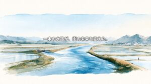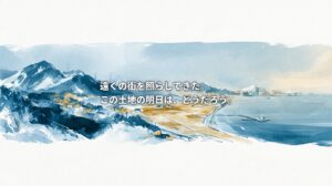
Kanagawa Prefecture is often described simply as a place next to Tokyo.
Yokohama, Kawasaki, Shonan, Kamakura, and Hakone are all widely recognized names in Japan. Each has developed a strong identity as a tourist destination, residential area, industrial center, or cultural landscape.
Yet proximity to Tokyo alone cannot explain Kanagawa.
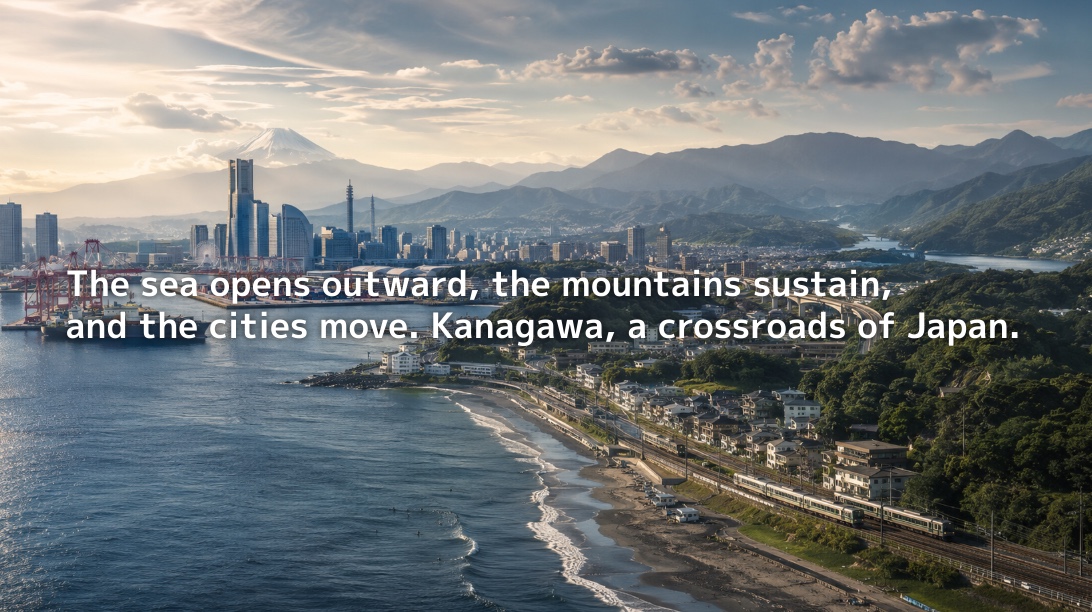
Kanagawa is home to port cities facing Tokyo Bay, coastal communities open to Sagami Bay, and mountain regions shaped by the Tanzawa and Hakone ranges. It also lies along the historic Tokaido corridor, one of Japan’s most important east–west routes, and functions as a major junction for people, goods, industry, and tourism throughout the Greater Tokyo Area.
Kanagawa is therefore not merely Tokyo’s outer edge.
It is one of Japan’s most complex territorial zones—a place where the sea, mountains, cities, industries, and transport networks overlap within a remarkably compact area.
Kanagawa Is Not a Large Prefecture—It Is a Dense One
Kanagawa is relatively small in terms of land area.
Its population, however, exceeds nine million, making it one of the most populous and densely inhabited prefectures in Japan. Preliminary results from Japan’s 2025 Population Census recorded 9,193,657 residents and 4,348,580 households in Kanagawa. Although the population had declined slightly from the previous census, the number of households had increased.
This contrast reveals an essential feature of Kanagawa.
Land is limited, yet people, industries, transportation systems, and cultural functions are concentrated at an exceptionally high density.
The prefecture contains major cities such as Yokohama and Kawasaki, the tourism and cultural zone of Shonan and Kamakura, inland transport hubs such as Sagamihara, Atsugi, and Ebina, and western gateways such as Odawara and Hakone.
Kanagawa does not compete through geographical size.
Its strength lies in the number of different functions it has accumulated within a limited territory.
Eastern Kanagawa: The Industrial and Port Geopolitics Created by Tokyo Bay
Eastern Kanagawa—particularly Yokohama and Kawasaki—developed through its relationship with Tokyo Bay.
The Port of Yokohama was one of the principal gateways through which modern Japan connected with the outside world. It remains a major center of international logistics today.
According to the City of Yokohama, the port handled approximately 47.68 million tonnes of cargo in 2025, an increase of 3.7 percent from the previous year. Container throughput reached approximately 3.18 million TEUs, exceeding three million units for the third consecutive year.
These figures demonstrate that Yokohama is not merely a picturesque waterfront destination. It remains a logistics city that supports the Japanese economy.
Kawasaki, meanwhile, developed as a central component of the Keihin Industrial Zone. The city has long accommodated industries related to petrochemicals, energy, materials, machinery, manufacturing, and research and development.
Although Kawasaki borders Tokyo, it has historically performed a different role.
While Tokyo became the center of politics, finance, administration, and information, eastern Kanagawa became the operational ground for ports, factories, logistics facilities, energy infrastructure, and industrial research.
Kanagawa’s Tokyo Bay coast supports the less visible foundations of the Greater Tokyo Area.
Beneath metropolitan life are container terminals, warehouses, factories, power facilities, laboratories, and transport networks.
The geopolitics of Kanagawa begins with this often-overlooked infrastructure.
Southern Kanagawa: A Coastal Culture Shaped by Sagami Bay
If eastern Kanagawa was shaped by the industry and logistics of Tokyo Bay, southern Kanagawa was shaped by Sagami Bay.
Kamakura, Zushi, Hayama, Fujisawa, Chigasaki, Hiratsuka, and Odawara stretch along or near the bay.
Life here moves at a different rhythm from that of the industrial waterfront.
Rather than container shipping and heavy industry, the character of this region has been formed by coastal living, fishing, tourism, holiday-home culture, surfing, literature, local food, and everyday relationships with the sea.
Shonan, in particular, has become more than a geographical name. It is also consumed and imagined as a lifestyle.
The sea is close, Mount Fuji can often be seen in the distance, and central Tokyo remains within commuting range.
This combination has created a distinctive residential culture along Kanagawa’s southern coast.
Sagami Bay, however, is not simply a beautiful seascape.
The region faces contemporary environmental problems, including coastal erosion, marine debris, declining seaweed beds, changes in fisheries resources, and transformations in the marine environment associated with climate change.
Kanagawa’s sea is both a tourism resource and a frontline where livelihoods, ecosystems, and environmental pressures meet.
Understanding the geopolitics of Sagami Bay means seeing the sea not merely as something to look at, but as a place where people live, work, produce food, and protect the environment.
Western Kanagawa: The Geopolitics of Water and Boundaries Created by Tanzawa and Hakone
Western Kanagawa is dominated by the Tanzawa and Hakone mountain ranges.
Official prefectural materials describe Kanagawa as a region bordered by the Hakone and Tanzawa mountains in the west and by Sagami Bay and other coastal waters in the south.
The Tanzawa Mountains lie in the northwestern part of the prefecture and form an important water-source region for Kanagawa’s residents.
The presence of these mountains fundamentally changes the character of the prefecture.
Despite being a highly urbanized prefecture next to Tokyo, Kanagawa contains water-source forests, hiking routes, hot springs, volcanic landforms, and memories of mountain worship.
Hakone is widely known as a tourist destination, but from a geopolitical perspective, it is also a mountain-pass region connecting the Kanto and Tokai areas.
Odawara and Hakone occupied strategic positions along the historic Tokaido route and served as western gateways into the Kanto region.
Tanzawa can also be understood as an enormous water infrastructure system behind the cities.
River systems such as the Sagami and Sakawa rivers support urban life, agriculture, manufacturing, energy production, and tourism.
Although Kanagawa is one of Japan’s most urbanized prefectures, it remains deeply dependent on its mountains, forests, and water systems.
This is another reason why Kanagawa cannot be understood simply as a commuter suburb of Tokyo.
Behind the cities are mountains. Within those mountains is water. That water, in turn, sustains the cities.
Central Kanagawa: An Inland Junction Created by the Sagami River and Transport Networks
The Sagami River flows from north to south through central Kanagawa.
Sagamihara, Atsugi, Ebina, Zama, Yamato, and Hiratsuka occupy this central zone.
The area differs from both the port cities of Yokohama and Kawasaki and the coastal tourism landscapes of Shonan.
Its defining feature is the geopolitics of inland transportation and logistics.
Major transport corridors—including the Tomei Expressway, Shin-Tomei Expressway, Ken-O Expressway, Odakyu Line, Sotetsu Line, and JR Sagami Line—intersect across the region.
As a result, central Kanagawa has become an important junction for freight movement, manufacturing, distribution, and commuting throughout the metropolitan region.
The development of cities such as Ebina and Atsugi is closely connected to their accessibility to Tokyo, Yokohama, Shizuoka, and Yamanashi.
This is neither the geopolitics of a port nor the geopolitics of tourism.
It is the geopolitics of movement, transfer, and connection.
Kanagawa extends along an east–west axis.
From Tokyo, it is a corridor toward western Japan. From Shizuoka, it is an entrance into the Greater Tokyo Area.
This condition of being a territory through which people and goods pass has shaped the industries, infrastructure, and urban form of central Kanagawa.
Kanagawa’s Economy: Where Urban Consumption and Manufacturing Coexist
Kanagawa has a strong identity as a place of consumption.
With major cities and tourist destinations such as Yokohama, Kawasaki, Shonan, Kamakura, and Hakone, commerce, services, hospitality, and tourism play significant roles in the prefectural economy.
At the same time, Kanagawa remains a major manufacturing prefecture.
Prefectural statistics place the value of manufactured goods shipments at approximately ¥18.23 trillion. Transportation equipment accounts for around 20.73 percent of the total by industrial category.
Kanagawa is therefore not only a place to live or visit.
It is also a place where things are made.
The coastal areas of Yokohama and Kawasaki contain heavy industries and logistics facilities. Central Kanagawa hosts automotive, machinery, technology, and research-related industries. Western Kanagawa combines tourism and agriculture with food production and businesses rooted in local natural and cultural resources.
This layered industrial structure is one of Kanagawa’s greatest strengths.
Kanagawa did not develop simply because it was close to Tokyo.
It developed because, while being close to Tokyo, it also possessed ports, coastlines, mountains, water systems, and major transportation corridors.
These geographical conditions enabled the prefecture to build an industrial structure distinct from that of the capital.
Kanagawa’s Vulnerabilities: Congestion and Division Behind Its Prosperity
Kanagawa is a prosperous prefecture.
Yet its prosperity exists alongside serious structural challenges.
The first is the concentration of people and urban functions.
Kanagawa has one of Japan’s largest prefectural populations, but its available land is limited. Residential districts, commercial centers, factories, tourist destinations, transport infrastructure, and protected natural areas often stand close together.
This makes conflicts over land use increasingly likely.
The second challenge is the divide between eastern and western Kanagawa.
The metropolitan areas of Yokohama and Kawasaki differ significantly from Odawara, Hakone, Ashigara, and other western districts in terms of population trends, industries, transportation, and economic pressures.
Areas closer to Tokyo experience stronger demand for commuting, commerce, housing, and redevelopment. Further west, tourism, agriculture, forests, water-source management, and population decline become more prominent concerns.
The third challenge involves the environmental risks of both the sea and mountains.
Kanagawa faces coastal change in Sagami Bay, forest conservation issues in Tanzawa, volcanic activity around Hakone, steep-slope hazards, earthquakes, and other natural risks.
The prefecture’s terrain includes the Hakone and Tanzawa mountain ranges in the west and northwest, as well as the Tama Hills, Miura Peninsula, and Sagamihara Plateau further east.
Sagami Bay is also connected to a tectonically active plate-boundary region.
Kanagawa is highly urbanized.
Precisely because of this urbanization, it can become easy to overlook its dependence on—and exposure to—the natural environment.
The sea is close. The mountains are close. Tokyo is close.
Each of these conditions is an advantage, but each is also a source of risk.
Kanagawa’s Future: From Tokyo’s Neighbor to an Independent Network of Regional Identities
One of the most important questions for Kanagawa’s future is how it should reinterpret its position next to Tokyo.
The prefecture has long developed as part of Tokyo’s commuter zone, as a residential destination for people working in the capital, and as an area absorbing the population and economic pressures of the metropolis.
That role alone, however, may no longer be sufficient.
Yokohama and Kawasaki can be redefined as centers of international logistics, research and development, culture, startups, and urban tourism.
Shonan, Kamakura, and the Miura Peninsula can become centers of coastal living, marine restoration, regional culture, food, and well-being.
Central Kanagawa can continue supporting the metropolitan region as a junction for transportation, logistics, manufacturing, and research.
Western Kanagawa can reconnect Hakone, Tanzawa, Odawara, and Ashigara through a new regional framework built around water sources, tourism, history, agriculture, and environmental stewardship.
Kanagawa’s future depends not simply on its proximity to Tokyo, but on its ability to connect and reinterpret the many identities that make it different from Tokyo.
Although Kanagawa is a single prefecture, it contains landscapes that can feel like several different countries.
There is the Kanagawa of ports.
The Kanagawa of industry.
The Kanagawa of coastal life.
The Kanagawa of mountains.
The Kanagawa of historic post towns.
The Kanagawa of commuter suburbs.
The Kanagawa of research and development.
And the Kanagawa of tourism and culture.
When these identities are viewed separately, Kanagawa can appear fragmented.
When they are read together on a single map, Kanagawa ceases to be merely “the prefecture next to Tokyo.”
Kanagawa is a territory where seas, mountains, cities, industries, and communities continuously collide, overlap, and adapt.
Its geopolitics is not defined by dramatic national borders.
It is written into daily journeys, containers moving through the port, lives along the coast, water flowing from the mountains, and the territories in which people work and live.
To understand Kanagawa is also to understand the future of the Greater Tokyo Area.
At the same time, it is to consider how cities and nature might continue to coexist.
Sources and References
- Kanagawa Prefecture: Preliminary Results of the 2025 Population Census—Population and Households in Kanagawa
- Kanagawa Prefecture: Kanagawa Prefectural Overview 2025
- Kanagawa Prefecture: Our Kanagawa Prefecture
- Kanagawa Prefecture: About the Tanzawa Mountains
- Kanagawa’s Water-Source Forests: Mountains, Forests, and the Natural Environment
- City of Yokohama: Preliminary Port of Yokohama Statistics for 2025
- City of Yokohama: Port of Yokohama Statistics
- Kanagawa Prefecture: Regional Statistical Indicators
- Japan Landslide Society: Overview of Kanagawa’s Topography and Geology
If you found this article interesting, please bookmark NEOTERRAIN Journal and return for the next installment of our series, “The Geopolitics of Japan’s 47 Prefectures.”
By reading the shape of the land, we can gradually discover a side of Japan that cannot be seen through tourism and daily news alone.